The latest Climate Prediction Center forecasts for the next 6 to 10 days are pretty emphatic: a greater probability of cooler and wetter conditions than normal--here are the graphics (click to enlarge):
And for those of you ready to make a crack about the fallacy of global warming, note that the eastern U.S. is experiencing a heat wave. Average the whole country and we are above normal!
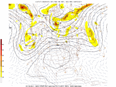
The causes of our cool, cloudy weather and their heat wave are the same: a persistent upper level flow pattern with a trough over the eastern Pacific and a ridge over the central U.S. I can't tell you why it has been so persistent. It could be random chance...like getting five heads in a row. Or perhaps it is forced by some slowly changing sea surface temperature anomaly. There are several possibilities.
The forecasts maintain this pattern for the next, with occasional strengthening of the trough leading to rain here on the western side of the Cascades. Take a look:
Tomorrow:

Sunday:

Tuesday:
Thursday:

You see the troughing along the West Coast in all of them? It is hard to tell them apart.
And the ensemble prediction system, which averages many forecasts to give us the best possible prediction, provides the same answer. In two weeks we will be in the middle of the meteorological summer--climatologically the driest and warmest time of the year.
Regarding the weekend, plan outside activities on Sunday...Saturday, particularly the morning, looks like a rain-out. On the good side, you will save money on watering your garden.


Post a Comment