An unusually heavy rainfall event for August is going to strike our region during the next two days, and its coming from the west and northwest--not the usual southwesterly direction of our big winter rains. Take a look at the latest satellite image above--see those clouds offshore?--they are the leading edge of the first a several, unusually strong, late summer disturbances that will strike soon.
How wet? Here are the latest 24-h rainfall total predictions for Washington State ending 5 PM Tuesday and Wednesday (click on the images to get larger images). The coast and western side of the Cascades get hammered, with 1-2 inches being widespread. Some locations may get 2-3.5 inches. The lowlands could receive .5 to 1 inches over the next two days. My advice: you won't have to water for a few days!


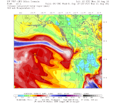
Here is the computer forecast of water vapor in the atmosphere (total from the surface to the upper atmosphere) for 11 PM tomorrow. See the extraordinary long plume stretching westward into the Pacific? If that graphic was larger you would see the tail dip down into the subtropics!

Later this week, a ridge of high pressure moves in, the thermal trough moves northward, and we get a few days of warmer weather. But the latest runs suggest it won't last. Sorry. The good thing is that this event will severely damp down the potential for wildfires.


Post a Comment